
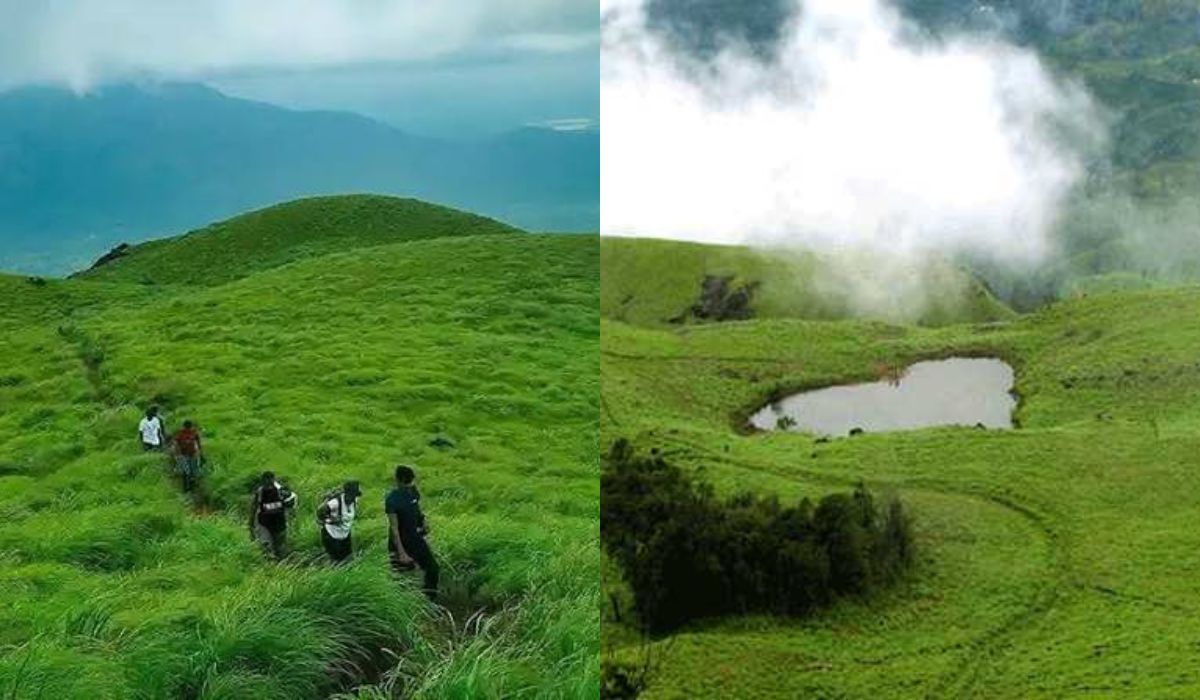
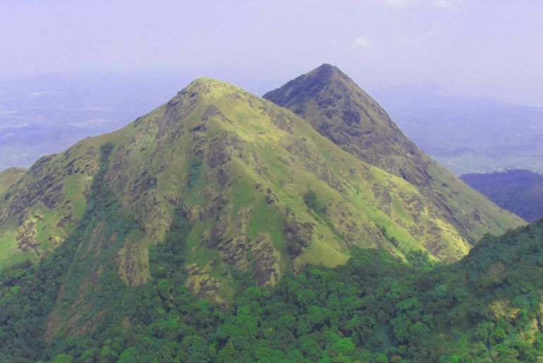
Chembra Peak, standing at 2,100 meters, is the highest peak in Wayanad, Kerala. The moderately difficult yet scenic trek is famous for Hridaya Saras (also known as Hridaya Thadakam) — a naturally heart-shaped lake — and breathtaking panoramic views of the Western Ghats. The trail passes through sprawling tea plantations and grasslands in Wayanad. Due to wildlife activity, access to the true summit is often restricted, but trekking is permitted up to the lake. It is also important to note that the trek route no longer extends to the actual mountain summit. The officially permitted trekking zone ends at the famous Heart-Shaped Lake, which now serves as the final destination and turnaround point for visitors. If you’re planning a trek to the Chembra Peak soon, make sure you save this unstumbled trekking guide!
Chembra Peak Trekking Guide: Permits, Fees, And Timings
Chembra Peak trekking is managed under strict visitor controls by the South Wayanad Forest Division. To regulate foot traffic and protect the natural habitat, entry is limited to exactly 200 trekkers per day on a first-come, first-served basis. Trekking passes are issued through the South Wayanad Forest Development Agency (SFDA). Although digital check-in facilities are available through the Kerala Forest Ecotourism portal, visitors must complete physical permit verification and clearance at the Chembra Peak VSS Forest Office in Meppadi before beginning the trek.
Entry Fees
- Individual Entry: INR 50 for Indian nationals; INR 100 for foreign nationals
- Group Trekking Base Charge (up to 5 people): INR 1,770 (includes a mandatory forest guide)
- Additional Trekkers: INR 800 per person beyond the base group limit
Details About The Trail
Total Distance: Around seven km round-trip (3.5 km one way)
Measured from the Meppadi VSS ticket window.
Trek Duration: Three to four hours total, including resting periods at the lake.
Trek Difficulty Level: Moderate, consisting of steep vertical gradients over wet grasslands.
Mandatory Requirement: Authorized forest guide; no solo unguided trekking permitted past the tower.
Timings: 7 AM to 12 PM (Permit counter window)
The trail officially closes to incoming hikers at 2 PM.
Step-By-Step Trekking Route: Navigating The Chembra Trail
1. The Meppadi Base To The Watchtower Checkpoint
The trek initiates through neatly manicured, private tea plantations. The path here is a wide, unpaved muddy road with a gradual incline. Most trekkers choose to skip walking this stretch by taking local forest jeeps or driving their private vehicles directly to the main Watchtower parking lot, where bags are inspected.
Distance: Zero to one kilometer
2. The Shola Forest Cover And Leech Zone
Once past the Watchtower checkpoint, you transition immediately into thick Shola forest terrain. The trail transforms into a single-file line over exposed tree roots, loose topsoil, and damp rocks. This section features heavy canopy shade and high humidity and requires close attention to foot placement.
Distance: 1 to 2.5 km
3. The High Grassland Ascent To Hridaya Saras
Emerging from the tree line, you enter steep, open shola grasslands. There is zero tree shade here. The trail climbs sharply over rocky ridges that become incredibly slick during downpours. Maintain a steady pace until the grade flattens out into an alpine meadow cradling the heart-shaped lake.
Distance: 2.5 to 3.5 km
4. The Turnaround Boundary At The Heart Lake
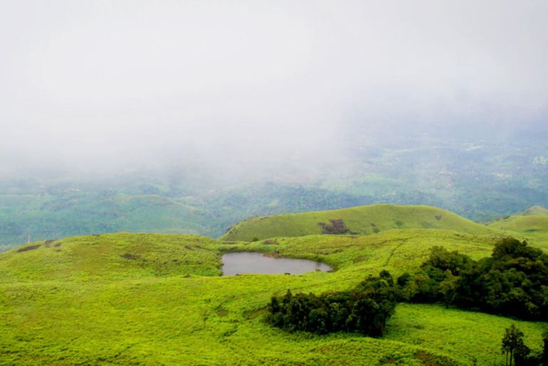
Arrive at the banks of Hridaya Saras (Eros Lake). Take photos from the elevated northern ridge to capture the perfect heart outline against the background peak. Swimming, wading, or throwing trash into the water is strictly prohibited, and guards will turn back anyone trying to climb higher toward the restricted summit.
Eco-Rules And Safety Precautions
The Plastic Security Deposit Rule
Chembra is a strict zero-plastic zone. At the Watchtower checkpoint, guards count every single plastic bottle wrapper and collect a mandatory cash deposit (typically INR 100 per bottle). Your bottles are labeled with custom stickers, and the deposit is refunded only upon presenting the exact stamped bottles on your descent.
The Seasonal Monsoon Closure Warning
Because Chembra sits directly in a high-intensity rainfall zone of the Western Ghats, the trail undergoes sudden, temporary closures during peak monsoon months (typically June through mid-August) due to flash flood risks, low visibility, and mudslides. Always cross-verify operational status with the Meppadi Forest Office before traveling in July or August.
Leech Protection Plan
The Shola forest floor stays perennially wet. Emphasize the necessity of carrying leech socks or applying a mixture of salt and tobacco powder around hiking boots to deter forest leeches.
Also Read: 7 Fun Things To Do In Wayanad For A Tranquil Holiday
Summing Up
While seasoned mountaineers might feel slightly discouraged by the absolute closure of the final 1.5-kilometer path to the true summit, the trek to the heart-shaped lake remains one of the premier eco-tourism experiences in South India. The combination of misty rolling tea hills, pristine shola grasslands, and a perfectly shaped natural mountain lake makes it a must-visit for anyone traveling through Wayanad — provided you plan your permit booking early in the morning.